| Marin Conservation League | 175 N. Redwood Dr., Ste. 135 | San Rafael CA 94903 | Tel 415.485.6257 | Fax 415.485.6259 Email Us. |
 |
Port Sonoma / Carneros Ranch Project
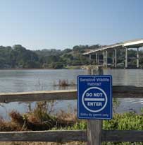
 Port Sonoma Marina lies just east and south of the Highway 37 bridge over the Petaluma River that divides Marin from Sonoma County. It is surrounded by low-lying ranch lands and wetlands that make up the large complex of former tidelands in Marin, Sonoma, and Napa Counties that were diked off from San Pablo Bay many decades ago. As a consequence of diking, most of these lands have subsided below mean sea level (MSL).
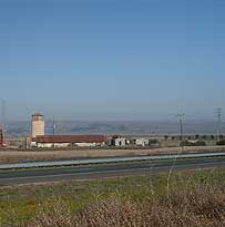
In July 2011, the owners of Port Sonoma, without full environmental review, were granted a permit by Sonoma County to receive 20 million cubic yards of dredge materials from sites around San Francisco and San Pablo Bays over a 20-year period and transfer them to the 528-acre Lower Ranch (aka Carneros Ranch,) immediately north of the port and Highway 37. As in the other diked lands, the elevation of the ranch currently is about minus 1-foot MSL. In January 2012, however, the developer agreed to a full environmental review.
As of summer 2013, the plan has apparently been withdrawn.The developer is looking into other options.
History
Located between Highway 37 and San Pablo Bay, Port Sonoma has been the focus of controversy on more than one occasion as the owners have sought to enhance its economic value. In 2006, Port Sonoma began pumping mud from dredging operations in Bel Marin Keys, across the Petaluma River, onto the Carneros Ranch, over which the Sonoma Land Trust holds an agricultural conservation easement. Although the land owner claimed it was a “demonstration project,” the Land Trust was justifiably concerned over the owner’s future plans and the threat to its easement.
In 2006 the Land Trust, joined by the Coastal Conservancy and the California Council of Land Trusts, filed suit to enforce the terms of the easement. After three years of litigation, a settlement was reached which allowed the landowners to place dredge material on the ranch according to strict protocols and performance standards, with the requirement that the affected farm land would remain in permanent agricultural production.
Impacts of the operation
In granting Port Sonoma a permit to transfer the dredge materials, the Sonoma County Board of Zoning Adjustments (BZA) required a Mitigated Negative Declaration of Impact to be prepared, but did not require an Environmental Impact Report (EIR), even though the potential impacts of the project are substantial.
According to the permit issued by the BZA, the port will barge and truck over one million cubic yards of dredge spoils per year for the next 20 years, with the objective of raising the elevation of the ranch to about 7 feet above mean sea level. Although most of the dredged material will be shipped to Port Sonoma by barge and then pumped to the site, the permit would allow over 20 percent to be shipped by truck over local highways.
Among other environmental concerns, the air quality impacts from the large number of diesel powered barges and trucks need to be evaluated, as do traffic impacts on Highway 37 from up to 7,400 annual dump truck trips. The large volume of barge traffic anticipated by the project also could impact the quality of Bay waters. In addition, if used as a dredge material transfer facility, the port, which is currently zoned for marina and visitor serving recreation, would become a de facto industrial facility. Raising the elevation of the ranch also presents a future threat to its continued use for agriculture and suggests a possible long-term plan to eventually convert the filled land to some other use, notwithstanding the agricultural easement and its enforcement.
Additionally, filling the land would preclude the option of ever restoring it to its historic, wetland condition.
Environmental opposition
In spite of Port Sonoma’s proximity to Marin County across the Petaluma River, no Marin County entity received notice of the permit hearing. MCL learned about the project only recently and has participated in a series of meetings with the Sonoma Group Sierra Club, Marin Audubon Society, Black Point Improvement Club, Sonoma County Water Coalition, and others.
The appeal focuses on the need for an EIR to be prepared before a project of this magnitude can be permitted, given the potential for long-term significant impacts on Bay waters, air quality, transportation, Petaluma River wetlands in both Sonoma and Marin Counties, growth potential and other impacts, and the need for mitigation.
2012 Documents and Correspondence
October 26, 2012; MCL comments on Carneros Ranch scoping


